
Without navigation, we would — very literally — be lost at sea. Navigation made it possible for early civilizations to explore new lands, establish trade routes and eventually connect with people on the other side of the world. Navigation allowed fishermen to find their way home and trade vessels to sail safely to foreign ports. Today, navigation enables a global economy by guiding ships, airplanes and trucks around the world using accurate and reliable navigation technology.
Marine navigation has come a long way from navigating with stars to tracking the position of ships with satellites. Let’s dive into the intriguing history of navigation, examine the timeline and explore the marine navigation tools that brought us to where we are today.
The Beginning of Navigation
In the early days of navigation at sea, mariners traveled along coastlines and always stayed in sight of land. Sailors compared the distance between landmarks on the shore to gauge their progress at sea and estimate their geographic position. Using recognizable landmarks, fishermen could find their way back to good fishing grounds, and traders could steer to distant ports.
However, using this visual navigation technique restricted sea travel to shorelines and could be challenging on foggy days or when visibility was poor. Sailors could only venture out into open waters when they could follow a wide continental shelf or rely on predictable ocean currents and winds.
In time, mariners developed new methods of navigation for traversing open waters. In many different regions of the world, early navigators created surprisingly accurate navigation techniques based on the sun, stars and other elements of their environment.
Watching the Sun
One of the simplest methods for determining a ship’s direction was to watch the movement of the sun across the sky. Sailors used the position of the sun as it moved from east to west to guide their route. At noon, they could determine north and south by the shadows the sun cast.
Navigating With Stars

When the sun set at night, sailors used the stars to navigate. Stars move across the sky from east to west, and some stars, called rise and set stars, begin and end their nightly path below the horizon. Sailors determined their heading by watching the movement of the stars the same way they watched the sun’s movement. Sailors measured the height of the stars in the sky to track their progress.
Sailors also used their knowledge of the constellations to navigate. Because constellations change seasonally, mariners had to know which constellations were visible in the sky at different times of the year in each hemisphere. Based on the location of certain constellations in the sky, sailors could determine what direction they were heading. The North Star was also a valuable marker for early navigators.
Following Sea Birds
Some early seafarers navigated by watching the flight of birds. A sea bird with a fish in its mouth was most likely flying back toward land to eat its catch, while a bird with an empty beak was likely flying out to sea to fish. Sailors on open waters followed seabirds back to the shore. This method of navigation was particularly useful in very Northern latitudes where the stars cannot be seen for multiple months in the summer.
Riding the Wind and Waves
In certain regions, early navigators determined their direction based on winds and water currents. In the Mediterranean, sailors distinguished between the warm south wind and cold north wind to get their bearings. Eventually, the eight principal winds were named and the directions of these winds became the points of the wind rose that was marked on early ocean charts.

Some early sailors, like the skillful Polynesian navigators, watched the direction and type of the waves to glean information about their position at sea. Polynesian sailors also closely tracked regional and seasonal weather patterns to effectively navigate the open ocean between islands in the Pacific. Around 400 AD, Polynesian sailors were able to travel 2,300 miles across the ocean from the Marquesas Islands to Hawaii.
Dead Reckoning
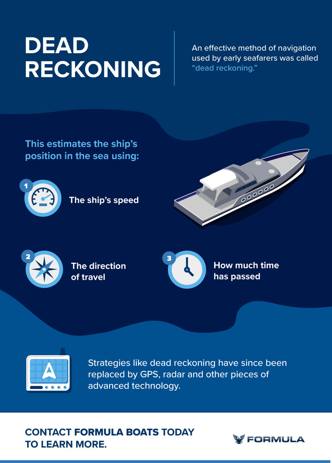
Another effective method of navigation used by early seafarers was dead reckoning. This estimates the ship’s position in the sea using:
- The ship’s speed
- The direction of travel
- How much time has passed
Navigators kept meticulous records during travel to steer the ship in the right direction. Based on the past position of the ship, sailors could determine their current location with enough accuracy to complete short ocean voyages.
However, because dead reckoning relies heavily on the past position of the ship, sailors could travel far off course if a small mistake was made in their calculations. Additionally, dead reckoning does not account for ocean currents and wind, so ships using dead reckoning could still go astray even when their calculations were correct. Because early sailors lacked sophisticated navigation technology, recognizing navigational mistakes was also extremely difficult when using dead reckoning.
Early Navigation Tools
Beginning in ancient times, sailors used marine navigation tools to determine their speed, position and direction of travel. While these tools were primitive at first, later advancements in math and science led to the development of more sophisticated navigation tools that greatly expanded the possibilities of sea travel.
Early tools that measured the angle of the stars and sun allowed sailors to determine their latitude based on how far these celestial bodies were from the horizon. Sailors could determine latitude easily with celestial navigation, but longitude could not be measured accurately until many centuries later, with the invention of the chronometer. This revolutionary technology, paired with existing tools for celestial navigation and a growing collection of accurate ocean charts, made it possible for explorers to travel throughout the world with precision and accuracy.
From the first seafarers to the rise of trade and exploration, these are some of the tools that shaped the history of navigation.
Tools for Measuring Depth and Speed
One of the oldest navigation tools, leadlines were used to determine the depth of the water under the ship. A leadline is a long rope with a lead weight attached at the end. Sailors dropped the line and recorded how much line it took to reach the bottom of the ocean. Viking sailors would measure the line based on the span of their arms as they hauled it back into the ship. These readings were called soundings and helped mariners navigate through inlets and along the coast.
During the 16th century, the invention of the chip log allowed sailors to calculate their approximate speed more accurately. A chip log is a line knotted at regular intervals and weighted at the end, so it drags in the water. To measure the speed of their ship, sailors dropped the line over the stern and counted the number of knots that went overboard during a certain period of time.
The chip log was an improvement on earlier methods for measuring speed while sailing, such as by dropping an object off the bow of the ship and counting how long it took to pass the stern of the ship.
The Mariners Compass
The compass was one of the earliest navigational tools and continues to play a crucial role in marine navigation. Although it is not known when the compass was first invented, there are stories of Chinese armies using magnetized iron to direct their troops as early as the third millennium B.C. In the West, the first mention of a compass used for navigation at sea was in the 12th century by the Englishman Alexander Neckham.
Although early navigators still relied heavily on celestial navigation, compasses made it possible for sailors to navigate on overcast days when they could not see the sun or stars. Early mariners compasses were made by placing a magnetized needle attached to a piece of wood into a bowl of water. Later the needle was attached to a card marked with the wind rose that is still familiar on compasses today.
Navigation Charts
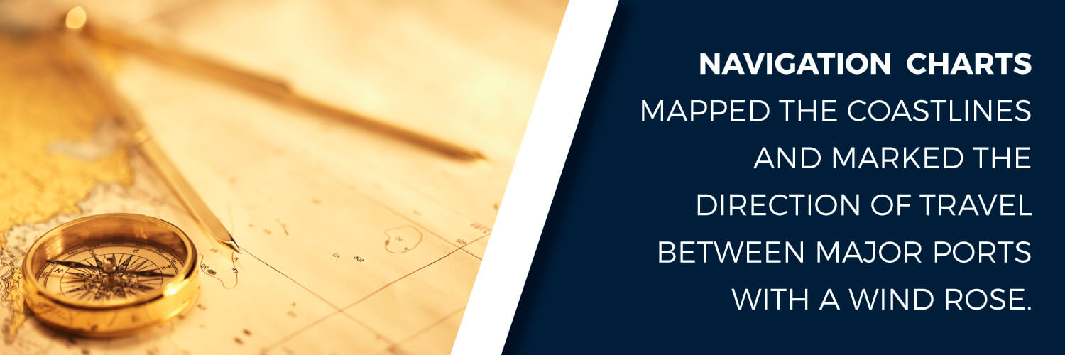
Early sailors relied on written directions, or pilot books, to navigate between ports. These books included detailed descriptions of routes using landmarks, ocean currents, wind directions and other observations. It was not until the 13th century that charts were created by compiling data recorded by sailors during their journeys. These charts mapped the coastlines and marked the direction of travel between major ports with a wind rose. Although these early mariner charts were considered very valuable, they were not very accurate and lacked latitude and longitude markings.
Tools for Celestial Navigation
Throughout history, seafarers around the world have experimented with different ways to measure the height of the sun and stars in the sky. From primitive models that required the user to look directly into the sun evolved the modern sextant, which can still be found aboard many ships today. Here are a few of the early marine navigation tools used for navigating by the skies:
Gnomon: This early version of a sundial was used to determine latitude based on the length of the sun’s shadow.
Kamal: The kamal was an Arabian navigation tool for determining latitude from the North Star. Sailors would hold a rectangular plate in front of their face so that the top edge lined up with the North Star and the bottom lined up with the horizon. By measuring the distance between the plate and the tip of their nose with string tied to the center of the plate, they could determine the latitude of the ship.
Sea astrolabe: In the Middle Ages, sailors used astrolabes to measure the height of the sun or stars in the sky. The Mariner’s astrolabe was a metal disc with a scale and ruler. By holding the disc at eye level from a ring at the top and adjusting the ruler, sailors could determine the altitude of celestial bodies. Sea astrolabes could be used on rough waters, which traditional astrolabes were not designed for.
Quadrant: Developed from astrolabes, quadrants were able to measure celestial bodies in much the same manner. Quadrants differed from astrolabes because they could measure just 90 degrees, rather than a full 360 degrees.
Cross-staff: Another navigation tool developed in the middle ages, the cross-staff was a long staff with a sliding crosspiece. A sailor would hold the base of the staff up to their eye and slide the crosspiece until the bottom lined up with the horizon and the top with a star or the sun.
Back-staff: When using a cross-staff to measure the height of the sun, the user had to look directly into the sun, which resulted in blindness. The back-staff was invented to solve this problem. The back-staff performed the same function as the cross-staff but was used with the sailor’s back facing the sun.
Sextant: In the 18th century, the sextant was invented independently by Thomas Godfrey in America and John Hadley in England. This advanced tool for celestial navigation allowed mariners to calculate their latitude extremely accurately. Sextants could be held vertically to measure the height of stars or held horizontally to measure the distance between two landmarks.
These marine navigation tools enabled ships to determine their position on the sea with increasing accuracy, but it was not until the invention of the chronometer that mariners could traverse the open waters with confidence and accuracy.
How Do Ships Navigate: With the Chronometer
Before the invention of the chronometer, sailors could only determine their latitude but not their longitude. Longitude was extremely difficult to calculate because it was based on the time difference between a ship’s current location and the location where the voyage began. Because clocks were not reliable enough to keep time accurately, longitude could only be estimated.
In the mid-1770s, the British clockmaker John Harrison invented the chronometer, which could keep time accurately regardless of changes in humidity or temperature. The marine chronometer allowed sailors to calculate their longitude so accurately that Captain James Cook was able to use it to circumnavigate the globe in 1779. Cook’s detailed charts significantly advanced marine navigation around the world.
Modern-Day Navigation Systems
By the start of the 20th century, navigation at sea had become precise and systematic. Sailors could travel great distances with accuracy for trading, fishing and exploration. But the methods of navigation continued to evolve, producing rapid advancements in navigation technology until the modern global positioning system (GPS) was created in the late 1970s.
Here are some of the primary advancements that defined modern navigation:
Gyroscopic compass: Invented in 1907, the gyroscopic compass could maintain its alignment with true north regardless of the ship’s or the Earth’s magnetic field. This improved upon magnetic compasses that could sometimes produce inaccurate readings.
Radio navigation: By tuning into a radio station, the tool helped sailors determine their position based on the direction of the broadcasting radio antenna and how long it took to receive radio signals.
Radar: A type of radio navigation, radar uses electromagnetic waves to determine the location of other objects. A radar system projects electromagnetic waves and then measures how long it takes for the waves to bounce back to the receiver. Radar is particularly beneficial for navigation at sea when visibility is low. Ships can still detect objects and ships in the water to avoid collisions.
Long-range navigation: Also known as LORAN, Long Range Navigation was developed during WWII to improve positioning accuracy at long distances. LORAN determines the position of a ship based on the time between signal pulses bounced between radio transmitters that are placed far apart.
Global positioning system: GPS employs the same technique as LORAN, except that it uses signals from satellites instead of radio transmitters. Because of its improved accuracy, GPS largely replaced LORAN in the late 20th century.
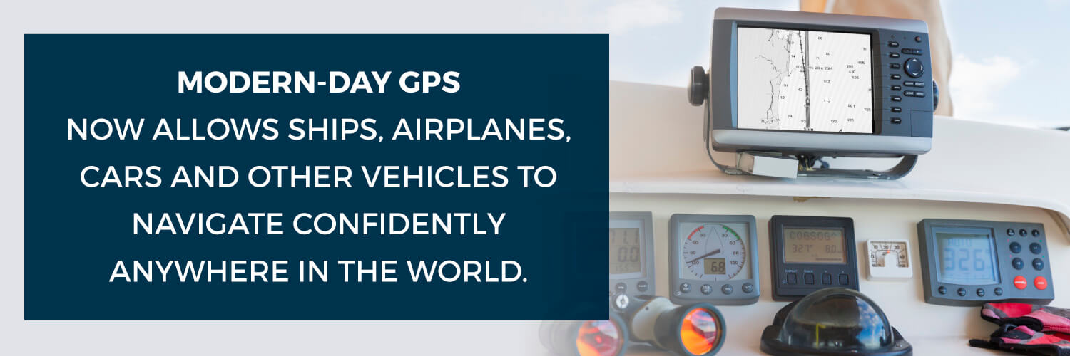
Modern-day GPS now allows ships, airplanes, cars and other vehicles to navigate confidently anywhere in the world. The precision of modern navigation techniques makes it possible for cargo ships to traverse busy waterways without collisions and cross wide spans of open ocean without losing their way. While some sailors may still be able to find their way from the stars, modern navigation has allowed ships to travel with greater precision and accuracy than ever before.
Find Out More About Formula Boats and Our Navigation Systems
Even if you aren’t planning to sail across the Pacific anytime soon, your recreational boat should still have a reliable and accurate navigation system. Whether you are heading out for the day to fish or enjoying a long weekend on the water, your navigation system helps you find your way and get home safely.
At Formula Boats, we strive to build the best powerboats on the market. From sleek styling to high-performance engines, our boats are designed to provide the best boating experience. When you purchase a boat from Formula Boats, you can also select a top-of-the-line GPS with depth sounders, color radar displays and chartplotters. Explore our line of premier powerboats or contact Formula Boats for more information about our advanced navigation systems and other performance features.