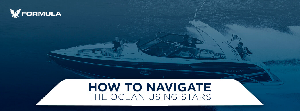
There is nothing quite like watching sparkling stars and bright constellations while you drift across the water in your boat. Stargazing from a boat is relaxing, entertaining and awe-inspiring — but it can also be useful. By observing the position of stars in the sky, you can find your bearing in unfamiliar waters and navigate strange seas. Star navigation has been used by seafarers for centuries and is a useful skill for any boater to know. Let’s explore the art of navigating the ocean using stars.
Hundreds of years ago, early navigators traversed the open ocean using only their eyes and the stars. These first seafarers tracked the movement of stars across the night sky and knew the positions of constellations during every season. Their extensive knowledge of celestial bodies allowed mariners to cross large spans of open water with confidence. However, as civilizations advanced, new navigational tools and equipment replaced celestial navigation. Modern seafarers can navigate with great accuracy using Global Positioning Systems (GPS), radar and other technologies. When boats are now equipped with advanced navigational systems, why should seafarers learn to navigate by the stars? Here are a few reasons to preserve the ancient art of star navigation:
Find your way in any situation: Even the best GPS equipment may break down or malfunction. If your boat’s GPS fails while you are out on the open water, celestial navigation can help you find your way. Star navigation may also come in handy when boating in sight of land without a GPS onboard. When the sun goes down, and you can no longer see those once familiar landmarks, stellar navigation will point you towards the shore.
Expand your knowledge of the world: Celestial navigation requires sufficient knowledge of stars and constellations. Mariners must be able to identify major stars and constellations and understand their movement in the sky. By learning how to navigate by stars, you expand your knowledge of the universe and learn more about how the world works.
Impress your friends: In addition to being useful and educational, star navigation is also fun. You’ll impress your friends with your ability to navigate using stars and can even share this fascinating art with them.
Despite modern innovations that allow for highly accurate navigation, navigating using stars remains a valuable and enjoyable skill. When you know how to navigate using the stars, you can always find your way home on a starry night.
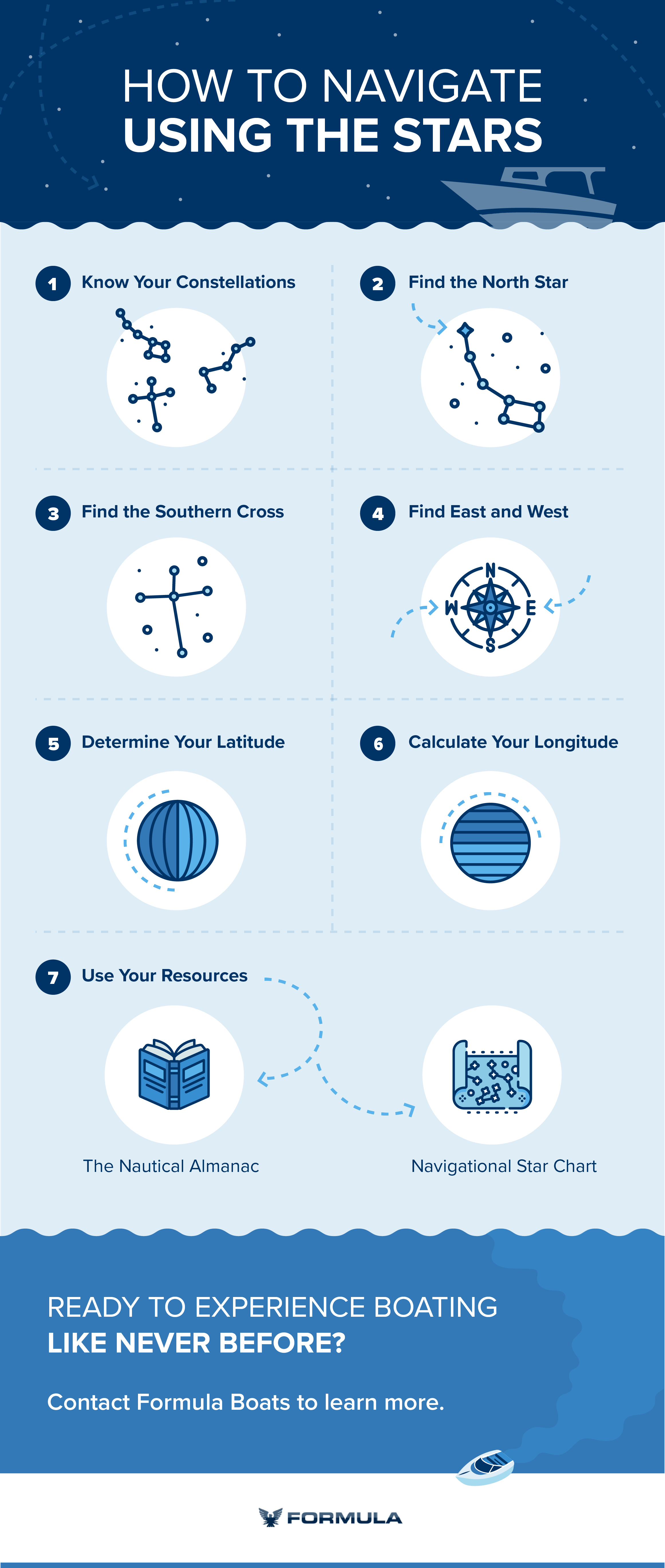
Throughout history, mariners have used many different techniques to navigate the ocean using stars. Here are some basic steps for star navigation in each hemisphere:
1. KNOW YOUR CONSTELLATIONS
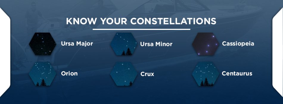
Celestial navigation relies heavily on the position and movement of the constellations. Constellations are groupings of stars that create recognizable patterns in the sky. As Earth orbits around the sun, these star patterns shift in the sky, making different constellations visible during different seasons. Some constellations, called circumpolar constellations, remain visible all year long in the hemisphere where they are located. Because circumpolar constellations never rise or set, they provide reliable reference points for astronavigation. Knowing the circumpolar constellations in each hemisphere allows navigators to find their way using only the stars. Here is a brief overview of the primary constellations in the Northern and Southern Hemispheres that are used for star navigation:
Ursa Major: Also called the Great Bear, Ursa Major is a large constellation in the Northern Hemisphere that resembles a bear. Ursa Major is best known for containing a group of seven bright stars called the Big Dipper. Shaped like a ladle, the Big Dipper is easy to spot in the northern sky and can be used to locate the North Star. The Big Dipper is also called the Saucepan, the Plough and the Great Wagon, among other names.
Ursa Minor: Also known as the Little Bear, Ursa Minor contains a grouping of stars called the Little Dipper. As its name suggests, the Little Dipper is a smaller version of the Big Dipper. The Little Dipper is also essential for celestial navigation because the North Star is the last star on the Little Dipper’s handle.
Cassiopeia: Cassiopeia is a group of five bright stars shaped like an irregular W. Located in the Northern Hemisphere, Cassiopeia can be used to find the North Star when the Big Dipper is not visible.
Orion: Also known as the Hunter, Orion is one of the most easily recognizable constellations in the Northern Hemisphere. Orion resembles a hunter holding a bow, with three bright stars forming Orion’s Belt and five stars marking the hunter’s feet, shoulders and head. Hanging from Orion’s Belt is a sword composed of three fainter stars. Orion has served as a guide for navigators for centuries.
Crux: Commonly called the Southern Cross, Crux is the most important constellation for navigating in the Southern Hemisphere, as it can be used to find due south. Crux contains five stars that form a slightly irregular cross and is the smallest constellation in the sky. The Southern Cross is visible from latitudes of about 27 degrees north and farther south.
Centaurus: One of the largest constellations in the sky, Centaurus resembles a centaur of Greek mythology. Centaurus is visible only in the Southern Hemisphere and can be used along with the Southern Cross to more accurately identify due south.
The ability to identify these important constellations is the first step towards navigating by the stars. Once you can find the navigational constellations in your hemisphere, you can then calculate your boat’s bearing.
2. FIND THE NORTH STAR
Since the first mariners braved the open ocean, the North Star has served as a reliable beacon to guide them home. The North Star, also called Polaris, is located almost directly above the North Pole and does not change position in the sky. The North Star moves in a very small circle above the north celestial pole, while all the other stars in the Northern Hemisphere rotate around it. Because Polaris appears stationary in the night sky, seafarers can easily find true north by locating the North Star. Depending on which constellations are visible in the sky, mariners can use a few different methods to find the North Star:
Find the Little Dipper: Because Polaris is also the end of Little Dipper’s handle, seafarers can find the North Star by locating this constellation. However, the Little Dipper is not as bright as the Big Dipper, making it more difficult to spot in the sky. Seafarers must also make sure not to mistake the Big Dipper for its smaller cousin when navigating by the stars.
Use the Big Dipper: Using the Big Dipper is often the easiest way to find the North Star. Locate the Big Dipper and find the two stars that form the front of the ladle. These pointer stars are called Merak and Dubhe. Follow a line through these two stars and straight out from the tip of the bowl. The North Star is located along this line, about five times the distance between Merak and Dubhe. If you reach Cassiopeia, you have gone too far.
Use Cassiopeia: If the Big Dipper is too low in the sky and hidden by the horizon, seafarers can use Cassiopeia to find the North Star. Because Cassiopeia is located on the opposite side of the North Star from the Big Dipper, it will be high in the sky when the Big Dipper is low. Simply follow a line straight out from the middle of the wider V in Cassiopeia to locate the North Star.
Once you find the North Star, drop your gaze to the horizon directly below Polaris in the sky — this will be due north.
3. FIND THE SOUTHERN CROSS
Because the North Star is only visible from the Northern Hemisphere, mariners boating south of the equator use another technique for navigating by the stars. Although the Southern Hemisphere does not have a bright pole star to follow, seafarers can still locate the south celestial pole using the Southern Cross. At latitudes farther south than 35 degrees south, the Southern Cross can be seen year-round at every hour of the night. No matter the time of year, the Southern Cross reaches its highest point in the night sky when it is pointed due south. At its apex, the Southern Cross will stand perfectly upright over the horizon with the long part of the cross pointing straight down and towards the south celestial pole. However, when the Southern Cross is not at its highest point in the sky, finding south requires a bit more calculation. Follow these steps to find due south using the Southern Cross:
Draw a line from the star at the top of the Southern Cross, called Gacrux, to the star at the bottom of the cross, called Acrux.
Extend this line approximately 4.5 times the distance between Gacrux and Acrux to locate the south celestial pole.
Drop your gaze to the point on the horizon directly below the south celestial pole to find due south.
Another more accurate method for finding south in the Southern Hemisphere uses the constellation Centaurus along with the Southern Cross. Centaurus is located next to the Southern Cross and has two bright pointer stars that make up the front leg of the centaur. These pointer stars, called Alpha Centauri and Beta Centauri, can easily be spotted in the southern sky and used to help locate the south celestial pole. Follow these steps to steer your ship south using Crux and Centaurus:
- Draw a line from Gacrux to Acrux and extend it past the end of the cross.
- Find the two pointer stars on Centaurus and locate the point directly between them.
- Extend a line perpendicular from that point until it intersects the line extended from the Southern Cross.
- The point where these two lines intersect is the south celestial pole.
- Look down from the south celestial pole to find due south on the horizon.
With careful observation and calculation, mariners in the Southern Hemisphere can find their bearing.
4. FIND EAST AND WEST
Once you have located due north in the Northern Hemisphere or due south in the Southern Hemisphere, finding east and west is simple. Stand facing directly north or south and stretch your arms out straight to each side. When facing north, your left arm points west and your right arm points east. When facing south, your right arm points west and your left arm points east. When traveling close to the equator, Orion also helps mariners find east and west. Orion rises in the east and sets in the west, with the rightmost star on Orion’s belt rising and setting within one degree of true east and true west every day. This star, called Mintaka, rises and sets first of the three stars on Orion’s belt. To use this method of identifying east and west, marine navigators must pay close attention to the movement of this constellation.
5. DETERMINE YOUR LATITUDE
Mariners in the Northern Hemisphere can measure their latitude, or position north or south of the equator, based on the height of the North Star in the sky. The angle of the North Star above the horizon will be the same as your boat’s latitude. Seafarers can measure latitude most accurately using tools like a sextant or quadrant, but latitude can also be estimated using only your hands. Extend your arms and make fists. Measure the distance between the horizon and the North Star by placing your fists one over the other. Each outstretched fist measures about ten degrees latitude. The same method can be applied in the Southern Hemisphere using the south celestial pole. First find the south celestial pole using the Southern Cross and Centaurus, and then measure the distance from the south celestial pole to the horizon with your fist. While this method will give only an estimate of latitude, it can prove valuable when navigating by stars without any tools or charts.
6. CALCULATE YOUR LONGITUDE
A savvy marine navigator knows that finding your bearing and latitude is only half the battle. To navigate on open waters, seafarers must also know their longitude, or their position east or west of the prime meridian. Unfortunately, longitude is extremely difficult to determine using the stars alone. Some early navigators may have calculated their longitude by tracking the movement of rise and set stars across the sky. By recording the position of a specific rise and set star every night at the same exact time, mariners could get a rough idea of how far they had traveled west or east the previous day. Star positions must be recorded every day of a journey, beginning with the known longitude of the location where the voyage began. This method of calculating longitude required careful record-keeping and was still prone to costly miscalculations. Luckily, innovations in marine navigation have made it possible to accurately and easily calculate longitude. Modern seafarers now use chronometers, charts and GPS to determine their exact position on the seas no matter where they are in the world.
7. USE YOUR RESOURCES
Although it is possible to navigate by the stars using only observation, there are several resources available to make celestial navigation easier and more accurate. Here are two of the primary resources for star navigation:
The Nautical Almanac: Published annually in the U.S. and U.K., the Nautical Almanac describes the position and movement of stars, planets, the sun and the moon each day of the year. This detailed navigational aid provides all of the celestial data necessary to determine your boat’s position on the ocean using the stars.
Navigational Star Chart: This chart features the 57 navigational stars, which were selected for their brightness and wide distribution across the sky. The Navigational Star Chart can be used to calculate position by finding the circle of position of three separate stars. The point where those circles intersect is the location of the boat.
By using these resources and keeping your eyes on the night sky, you can learn to navigate accurately using stars.
Learn More About Formula Boats and Our Navigation Systems
If you want to try your hand at navigating by the stars, you can head out confidently in your Formula boat with the knowledge that your reliable navigation system is always there to back you up. If you find yourself heading the wrong direction, the advanced GPS in your Formula boat can get you back on track right away. Formula Boats are built with the best equipment and materials to provide a safe and luxurious boating experience. When you purchase a powerboat from Formula Boats, you’ll enjoy beautiful styling, exceptional performance and a powerful engine — as well as your choice of top-notch navigation systems. Formula powerboats are fully customizable with a variety of features available to suit your boating style. If you’re ready to experience the boating like never before, contact Formula Boats to learn more about our premier powerboats.